


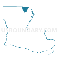
Precinct 12, Morehouse Parish, Louisiana
About
Outline

Summary
| Unique Area Identifier | 589693 |
| Name | Precinct 12 |
| County | Morehouse Parish |
| State | Louisiana |
| Area (square miles) | 0.78 |
| Land Area (square miles) | 0.78 |
| Water Area (square miles) | 0.00 |
| % of Land Area | 100.00 |
| % of Water Area | 0.00 |
| Latitude of the Internal Point | 32.76280560 |
| Longtitude of the Internal Point | -91.93311690 |
Maps


Graphs
Select a template below for downloading or customizing gragh for Precinct 12, Morehouse Parish, Louisiana


Neighbors
Neighoring Voting District (by Name) Neighboring Voting District on the Map
- Precinct 1, Morehouse Parish, LA
- Precinct 10, Morehouse Parish, LA
- Precinct 13, Morehouse Parish, LA
- Precinct 39, Morehouse Parish, LA
Top 10 Neighboring County Subdivision (by Population) Neighboring County Subdivision on the Map
- District 4, Morehouse Parish, LA (4,464)
- District 7, Morehouse Parish, LA (3,643)
- District 6, Morehouse Parish, LA (3,136)